Geolocate

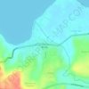
Meat topographic map

Click on the map to display elevation.

About this map

Name: Meat topographic map, elevation, terrain.

Location: Meat, Tampahan, Kabupaten Toba, North Sumatra, Indonesia (2.30304 98.98508 2.34304 99.02508)

Average elevation: 3,612 ft

Minimum elevation: 2,923 ft

Maximum elevation: 5,240 ft

Other topographic maps

Click on a map to view its topography, its elevation and its terrain.
Balige

Indonesia > North Sumatra > Kabupaten Toba

Average elevation: 3,009 ft

Borbor

Indonesia > North Sumatra > Kabupaten Toba

Average elevation: 4,163 ft

Gear up for your next adventure:

🥘Titanium Cookware - Durable, featherlight pots and pans for backpacking
🎒Trail Energy Bars - High‑calorie bars for hiking energy
🔦LED Headlamp - Bright and durable LED headlamp for night navigation
🪶Trail Camera - Capture wildlife on your hikes
🛏️Cold Weather Sleeping Bag - Warm sleeping bag for cold conditions

As an Amazon Associate, this site earns from qualifying purchases at no extra cost to you.