Geolocate

Caribe topographic map

Click on the map to display elevation.

About this map
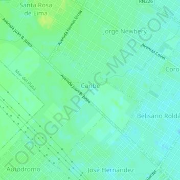
Name: Caribe topographic map, elevation, terrain.

Location: Caribe, Mar del Plata, Partido de General Pueyrredón, Buenos Aires, Argentina (-37.98572 -57.62922 -37.97321 -57.61161)

Average elevation: 89 ft

Minimum elevation: 69 ft

Maximum elevation: 112 ft

Other topographic maps

Click on a map to view its topography, its elevation and its terrain.
Gear up for your next adventure:

🚑Emergency Bivvies - Heat-reflective sleeping bags for survival situations
🎁Geography Themed Gifts - Unique gift ideas for map lovers and geography enthusiasts
🌄Hiking Binoculars - Compact binoculars for scenic views and trail spotting
📖Nature Tracking Books - Learn to track wildlife and terrain
🎒Trail Energy Bars - High‑calorie bars for hiking energy

As an Amazon Associate, this site earns from qualifying purchases at no extra cost to you.