Geolocate

Mt. Haruna topographic map

Click on the map to display elevation.

About this map

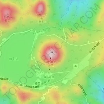
Name: Mt. Haruna topographic map, elevation, terrain.

Location: Mt. Haruna, Takasaki, Gunma Prefecture, 377-0102, Japan (36.47688 138.87819 36.47698 138.87829)

Average elevation: 3,678 ft

Minimum elevation: 3,061 ft

Maximum elevation: 4,498 ft

Gear up for your next adventure:

🧭Hiking Compass - Precision compass for reliable navigation in the wilderness
👓Polarized Sunglasses - Outdoor sunglasses for glare reduction
🎁Geography Themed Gifts - Unique gift ideas for map lovers and geography enthusiasts
👟Men's Trail Runners - Lightweight footwear for fast-paced exploration and light hiking
🧭Pro Hiking Compasses - High-accuracy liquid-filled compasses for topographic orientation

As an Amazon Associate, this site earns from qualifying purchases at no extra cost to you.