Geolocate

Seven Lakes topographic map

Click on the map to display elevation.

About this map

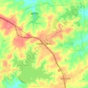
Name: Seven Lakes topographic map, elevation, terrain.

Location: Seven Lakes, Moore County, North Carolina, United States (35.23458 -79.62236 35.29166 -79.54994)

Average elevation: 551 ft

Minimum elevation: 420 ft

Maximum elevation: 673 ft

Moore County trails, hiking, mountain biking, running and outdoor activities

Other topographic maps

Click on a map to view its topography, its elevation and its terrain.

Spies

United States > North Carolina > Moore County

Average elevation: 482 ft

Lobelia

United States > North Carolina > Moore County

Average elevation: 236 ft

Sandhill

United States > North Carolina > Moore County > Foxfire

Average elevation: 456 ft

Gear up for your next adventure:

📦Gear Storage Bags - Organize and protect outdoor equipment
📌Outdoor GPS Map App - Apps and devices for digital topographic navigation
🚗GPS Dash Cams - Record your scenic drives through mountain passes and canyons
🎒Waterproof Dry Bags - Keep your electronics and maps dry inside your pack
🛠️Outdoor Gear Repair Kit - Essential tools to fix gear on the trail

As an Amazon Associate, this site earns from qualifying purchases at no extra cost to you.