Geolocate

Skjolden topographic map

Click on the map to display elevation.

About this map

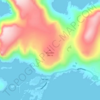
Name: Skjolden topographic map, elevation, terrain.

Location: Skjolden, Sørvær, Hasvik, Troms og Finnmark, 9595, Norway (70.64002 21.98949 70.64012 21.98959)

Average elevation: 410 ft

Minimum elevation: -3 ft

Maximum elevation: 1,184 ft

Gear up for your next adventure:

🛠️Outdoor Gear Repair Kit - Essential tools to fix gear on the trail
🌲Outdoor Survival Books - Best books on survival skills
🧯Emergency Survival Kit - All‑in‑one survival essentials for the backcountry
📖Nature Tracking Books - Learn to track wildlife and terrain
🦟Ultrasonic Repellers - Create a bug-free zone at your camp or rest stop

As an Amazon Associate, this site earns from qualifying purchases at no extra cost to you.