Geolocate

Nami Island topographic map

Click on the map to display elevation.

About this map

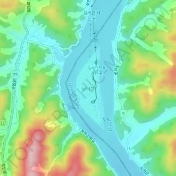
Name: Nami Island topographic map, elevation, terrain.

Location: Nami Island, Chuncheon-si, Gangwon State, 24464, South Korea (37.78543 127.52273 37.79813 127.52837)

Average elevation: 351 ft

Minimum elevation: 141 ft

Maximum elevation: 850 ft

Other topographic maps

Click on a map to view its topography, its elevation and its terrain.

Geumsan-ri

South Korea > Chuncheon-si

Average elevation: 325 ft

24265

South Korea > Chuncheon-si

Average elevation: 318 ft

24449

South Korea > Chuncheon-si

Average elevation: 341 ft

24422

South Korea > Chuncheon-si

Average elevation: 364 ft

24266

South Korea > Chuncheon-si

Average elevation: 312 ft

24465

South Korea > Chuncheon-si

Average elevation: 725 ft

Sudong-ri

South Korea > Chuncheon-si

Average elevation: 699 ft

24277

South Korea > Chuncheon-si

Average elevation: 361 ft

24279

South Korea > Chuncheon-si

Average elevation: 364 ft

24333

South Korea > Chuncheon-si

Average elevation: 331 ft

Gear up for your next adventure:

🗺️Topographic Maps - Detailed topo maps for hiking, exploring and outdoor navigation
🛠️Backpacking Tool Kit - Essential toolkit for outdoor repairs
🩹Survival Bandages - High‑quality bandages for emergencies
🔦LED Headlamp - Bright and durable LED headlamp for night navigation
Backpacking Tent - Lightweight and durable tent for multi‑day hikes

As an Amazon Associate, this site earns from qualifying purchases at no extra cost to you.