Geolocate

Meransen - Maranza topographic map

Click on the map to display elevation.

Meransen - Maranza

Meransen (Italian: Maranza) is a village in South Tyrol, Italy, in the Mühlbach municipality between Pustertal and Eisacktal. It located on the slopes of the Gitschberg mountain at an altitude of 1,414 m (4,639 ft).

About this map
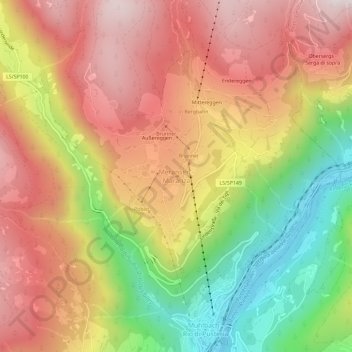
Name: Meransen - Maranza topographic map, elevation, terrain.

Location: Meransen - Maranza, Mühlbach - Rio di Pusteria, Eisacktal - Valle Isarco, South Tyrol, Trentino – Alto Adige/Südtirol, 39037, Italy (46.79335 11.64200 46.83335 11.68200)

Average elevation: 4,196 ft

Minimum elevation: 2,343 ft

Maximum elevation: 5,719 ft

Gear up for your next adventure:

🔊Portable Camp Speaker - Music and alerts at camp
🧼Biodegradable Camping Soap - Eco‑friendly soap for outdoor hygiene
🪶Trail Camera - Capture wildlife on your hikes
🧤Hiking Gloves - Protective gloves for rugged trails
🦺Reflective Outdoor Gear - Safety gear for low‑light conditions

As an Amazon Associate, this site earns from qualifying purchases at no extra cost to you.