
Thank you for supporting this site ❤️
Make a donation
Make a donation
Gear up for your next adventure:
As an Amazon Associate, this site earns from qualifying purchases at no extra cost to you.
Rajhena topographic map
Click on the map to display elevation.
Thank you for supporting this site ❤️
Make a donation
Make a donation
Gear up for your next adventure:
As an Amazon Associate, this site earns from qualifying purchases at no extra cost to you.
About this map
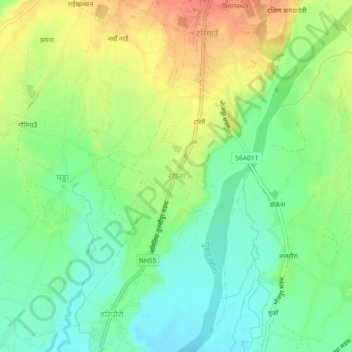
Name: Rajhena topographic map, elevation, terrain.
Location: Rajhena, Tulsipur, Dang, 22412, Nepal (28.06995 82.26623 28.10995 82.30623)
Average elevation: 1,978 ft
Minimum elevation: 1,903 ft
Maximum elevation: 2,077 ft
Thank you for supporting this site ❤️
Make a donation
Make a donation
Gear up for your next adventure:
As an Amazon Associate, this site earns from qualifying purchases at no extra cost to you.