
Venice topographic map
Click on the map to display elevation.
About this map
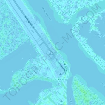
Name: Venice topographic map, elevation, terrain.
Location: Venice, Plaquemines Parish, Louisiana, 70091, United States (29.25906 -89.37874 29.29906 -89.33874)
Average elevation: 0 ft
Minimum elevation: -16 ft
Maximum elevation: 20 ft
Plaquemines Parish trails, hiking, mountain biking, running and outdoor activities
Other topographic maps
Click on a map to view its topography, its elevation and its terrain.
Empire
United States > Louisiana > Plaquemines Parish
Empire is located at 29°23′55″N 89°36′31″W / 29.39861°N 89.60861°W / 29.39861; -89.60861 (29.398586, -89.608501) and has an elevation of 3 feet (0.9 m).
Average elevation: 3 ft