Geolocate

Macmerry topographic map

Click on the map to display elevation.

About this map

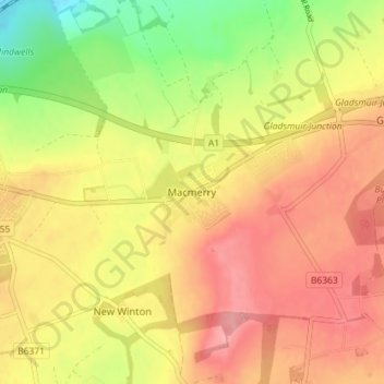
Name: Macmerry topographic map, elevation, terrain.

Location: Macmerry, East Lothian, Scotland, EH33 1RA, United Kingdom (55.92185 -2.92720 55.96185 -2.88720)

Average elevation: 299 ft

Minimum elevation: 98 ft

Maximum elevation: 440 ft

Gear up for your next adventure:

📶Vehicle Signal Boosters - Improve reception in rural areas while driving to trailheads
🧣Hiking Neck Gaiter - Multi‑use neck protection for outdoor weather
🎒Trail Energy Bars - High‑calorie bars for hiking energy
🌐World Map Poster - Decorative world maps with topographic info
❄️Traction Cleats - Prevent slips on icy trails during winter hikes

As an Amazon Associate, this site earns from qualifying purchases at no extra cost to you.