
Thank you for supporting this site ❤️
Make a donation
Make a donation
Gear up for your next adventure:
As an Amazon Associate, this site earns from qualifying purchases at no extra cost to you.
Tantol topographic map
Click on the map to display elevation.
Thank you for supporting this site ❤️
Make a donation
Make a donation
Gear up for your next adventure:
As an Amazon Associate, this site earns from qualifying purchases at no extra cost to you.
About this map
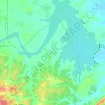
Name: Tantol topographic map, elevation, terrain.
Location: Tantol, Khamnor Tehsil, Rajsamand, Rajasthan, 313301, India (24.90474 73.74287 24.94474 73.78287)
Average elevation: 1,946 ft
Minimum elevation: 1,864 ft
Maximum elevation: 2,172 ft
Thank you for supporting this site ❤️
Make a donation
Make a donation
Gear up for your next adventure:
As an Amazon Associate, this site earns from qualifying purchases at no extra cost to you.