
Thank you for supporting this site ❤️
Make a donation
Make a donation
Gear up for your next adventure:
As an Amazon Associate, this site earns from qualifying purchases at no extra cost to you.
Soraba topographic map
Click on the map to display elevation.
Thank you for supporting this site ❤️
Make a donation
Make a donation
Gear up for your next adventure:
As an Amazon Associate, this site earns from qualifying purchases at no extra cost to you.
About this map
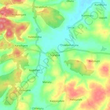
Name: Soraba topographic map, elevation, terrain.
Location: Soraba, Soraba taluk, Shimoga, Karnataka, 577429, India (14.33898 75.05378 14.41898 75.13378)
Average elevation: 1,972 ft
Minimum elevation: 1,857 ft
Maximum elevation: 2,139 ft
Thank you for supporting this site ❤️
Make a donation
Make a donation
Gear up for your next adventure:
As an Amazon Associate, this site earns from qualifying purchases at no extra cost to you.