
Abu Hamad topographic map
Interactive map
Click on the map to display elevation.
About this map
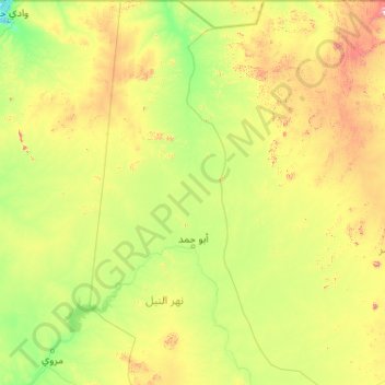
Name: Abu Hamad topographic map, elevation, terrain.
Location: Abu Hamad, Nil-Fluss, Sudan (18.13249 32.21477 22.00000 33.79761)
Average elevation: 1,378 ft
Minimum elevation: 581 ft
Maximum elevation: 5,640 ft
Other topographic maps
Click on a map to view its topography, its elevation and its terrain.
As Suweigat
Sudan > Nil-Fluss > Abu Hamad > As Suweigat
As Suweigat, Abu Hamad, Nil-Fluss, Sudan
Average elevation: 971 ft