Geolocate

Bad Steben topographic map

Click on the map to display elevation.

About this map

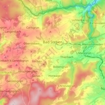
Name: Bad Steben topographic map, elevation, terrain.

Location: Bad Steben, Landkreis Hof, Bavaria, 95138, Germany (50.31680 11.59663 50.39879 11.68175)

Average elevation: 1,952 ft

Minimum elevation: 1,371 ft

Maximum elevation: 2,474 ft

Other topographic maps

Click on a map to view its topography, its elevation and its terrain.

Stegenwaldhaus

Germany > Bavaria > Landkreis Hof > Selbitz

Average elevation: 1,923 ft

Rudolphstein

Germany > Bavaria > Landkreis Hof

Average elevation: 1,703 ft

Carlsgrün

Germany > Bavaria > Landkreis Hof > Bad Steben

Average elevation: 2,008 ft

Gear up for your next adventure:

🥄Camping Utensil Set - Lightweight utensils for outdoor meals
🔥Plasma Lighters - Windproof lighters that work in any weather condition
🔪Outdoor Multitools - Essential survival tools for gear repair and field use
📱Heavy-Duty Phone Cases - Drop-proof and waterproof protection for outdoor navigation
🦺Reflective Outdoor Gear - Safety gear for low‑light conditions

As an Amazon Associate, this site earns from qualifying purchases at no extra cost to you.