Geolocate

Heiloo topographic map

Click on the map to display elevation.

About this map

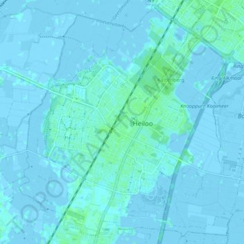
Name: Heiloo topographic map, elevation, terrain.

Location: Heiloo, North Holland, Netherlands (52.57874 4.67062 52.62503 4.75214)

Average elevation: 3 ft

Minimum elevation: -10 ft

Maximum elevation: 16 ft

Gear up for your next adventure:

🔦LED Headlamp - Bright and durable LED headlamp for night navigation
GPS Sports Watch - GPS watch for running, hiking and training
🩳Quick‑Dry Hiking Shorts - Comfortable and quick‑dry shorts for summer hiking
🧦Hiking Socks - Comfortable socks to prevent blisters on long hikes
🚑Emergency Bivvies - Heat-reflective sleeping bags for survival situations

As an Amazon Associate, this site earns from qualifying purchases at no extra cost to you.