Geolocate

Laim topographic map

Click on the map to display elevation.

About this map

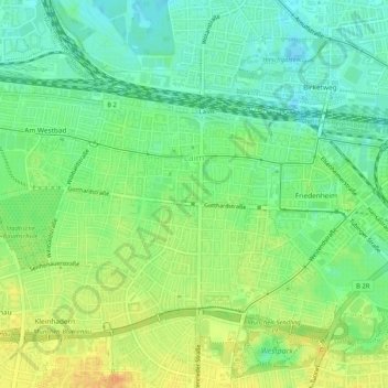
Name: Laim topographic map, elevation, terrain.

Location: Laim, Munich, Bavaria, Germany (48.12522 11.48276 48.14738 11.53439)

Average elevation: 1,745 ft

Minimum elevation: 1,696 ft

Maximum elevation: 1,804 ft

Gear up for your next adventure:

🪶Wildlife Field Guides - Learn animal tracking and species ID
📱Heavy-Duty Phone Cases - Drop-proof and waterproof protection for outdoor navigation
🥾Hiking Shoes - Durable and comfortable shoes for trail hiking
🦶Carbon Trekking Poles - Reduce knee impact on steep descents with ultra-light poles
🧭Hiking Compass - Precision compass for reliable navigation in the wilderness

As an Amazon Associate, this site earns from qualifying purchases at no extra cost to you.