
Thank you for supporting this site ❤️
Make a donation
Make a donation
Gear up for your next adventure:
As an Amazon Associate, this site earns from qualifying purchases at no extra cost to you.
Avintes topographic map
Click on the map to display elevation.
Thank you for supporting this site ❤️
Make a donation
Make a donation
Gear up for your next adventure:
As an Amazon Associate, this site earns from qualifying purchases at no extra cost to you.
About this map
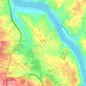
Name: Avintes topographic map, elevation, terrain.
Location: Avintes, Vila Nova de Gaia, Porto, Portugal (41.08238 -8.57182 41.12619 -8.52163)
Average elevation: 249 ft
Minimum elevation: -3 ft
Maximum elevation: 591 ft
Thank you for supporting this site ❤️
Make a donation
Make a donation
Gear up for your next adventure:
As an Amazon Associate, this site earns from qualifying purchases at no extra cost to you.