
Thank you for supporting this site ❤️
Make a donation
Make a donation
Gear up for your next adventure:
As an Amazon Associate, this site earns from qualifying purchases at no extra cost to you.
Melrose topographic map
Click on the map to display elevation.
Thank you for supporting this site ❤️
Make a donation
Make a donation
Gear up for your next adventure:
As an Amazon Associate, this site earns from qualifying purchases at no extra cost to you.
About this map
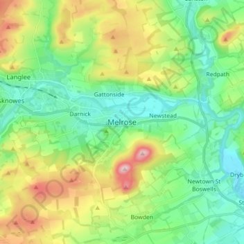
Name: Melrose topographic map, elevation, terrain.
Location: Melrose, Scottish Borders, Scotland, TD6 9PQ, United Kingdom (55.55759 -2.75997 55.63759 -2.67997)
Average elevation: 577 ft
Minimum elevation: 223 ft
Maximum elevation: 1,339 ft
Thank you for supporting this site ❤️
Make a donation
Make a donation
Gear up for your next adventure:
As an Amazon Associate, this site earns from qualifying purchases at no extra cost to you.