
Make a donation
Gear up for your next adventure:
As an Amazon Associate, this site earns from qualifying purchases at no extra cost to you.
Haardt topographic map
Click on the map to display elevation.
Make a donation
Gear up for your next adventure:
As an Amazon Associate, this site earns from qualifying purchases at no extra cost to you.
Haardt
Im Westen wird der Gebirgszug durch die Lambrechter Verwerfung vom inneren Pfälzerwald abgegrenzt. Diese nach der Stadt Lambrecht benannte Störungslinie verläuft in einem Abstand von etwa 2 bis 5 km parallel zum Grabenrand und hat zur Versetzung verschiedener Gesteinsschichten um 80 bis 100 m geführt. Deshalb sind in der Haardt z. B. die Formationen des Unteren oder Mittleren Buntsandsteins in entsprechend geringerer Höhe als weiter im Westen anzutreffen.
Make a donation
Gear up for your next adventure:
As an Amazon Associate, this site earns from qualifying purchases at no extra cost to you.
About this map
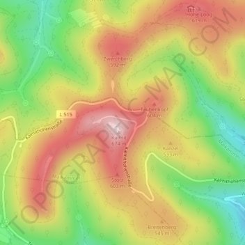
Name: Haardt topographic map, elevation, terrain.
Average elevation: 1,588 ft
Minimum elevation: 919 ft
Maximum elevation: 2,201 ft
Make a donation
Gear up for your next adventure:
As an Amazon Associate, this site earns from qualifying purchases at no extra cost to you.