
Thank you for supporting this site ❤️
Make a donation
Make a donation
Gear up for your next adventure:
As an Amazon Associate, this site earns from qualifying purchases at no extra cost to you.
Pomieri topographic map
Click on the map to display elevation.
Thank you for supporting this site ❤️
Make a donation
Make a donation
Gear up for your next adventure:
As an Amazon Associate, this site earns from qualifying purchases at no extra cost to you.
About this map
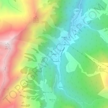
Name: Pomieri topographic map, elevation, terrain.
Location: Pomieri, Prali / Prâl, Prali, Turin, Piémont, Italie (44.85865 7.01751 44.89865 7.05751)
Average elevation: 6,585 ft
Minimum elevation: 4,695 ft
Maximum elevation: 9,783 ft
Thank you for supporting this site ❤️
Make a donation
Make a donation
Gear up for your next adventure:
As an Amazon Associate, this site earns from qualifying purchases at no extra cost to you.