Geolocate

Colcha topographic map

Click on the map to display elevation.

About this map

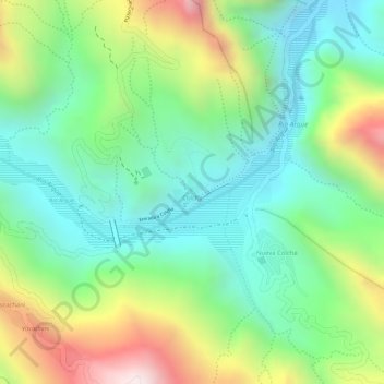
Name: Colcha topographic map, elevation, terrain.

Location: Colcha, Municipio Arque, Arque, Cochabamba, Bolivia (-17.85305 -66.42710 -17.85062 -66.42475)

Average elevation: 9,905 ft

Minimum elevation: 9,042 ft

Maximum elevation: 11,407 ft

Gear up for your next adventure:

🪶Wildlife Field Guides - Learn animal tracking and species ID
🦶Hiking Gaiters - Keep debris and water out of your boots
📶Satellite Messenger - Communication device off‑grid
💧Water Purification System - Clean water on the trail with reliable purifiers
🌧️Backpack Rain Cover - Keep gear dry in wet weather

As an Amazon Associate, this site earns from qualifying purchases at no extra cost to you.