Geolocate

Bosco topographic map

Click on the map to display elevation.

About this map

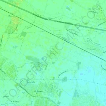
Name: Bosco topographic map, elevation, terrain.

Location: Bosco, Rubano, Province of Padua, Veneto, 35030, Italy (45.42319 11.77601 45.46319 11.81601)

Average elevation: 56 ft

Minimum elevation: 39 ft

Maximum elevation: 72 ft

Gear up for your next adventure:

📦Dry Bags Set - Waterproof storage for electronics and clothes
📚Navigation Handbooks - Master the art of reading topographic maps and using a compass
📡GPS Antenna Upgrade - Enhance GPS reception in remote terrain
👓Polarized Sunglasses - Outdoor sunglasses for glare reduction
🏕️Family Camping Gear - Essentials for group camping trips

As an Amazon Associate, this site earns from qualifying purchases at no extra cost to you.