
Aguiar topographic map
Interactive map
Click on the map to display elevation.
About this map
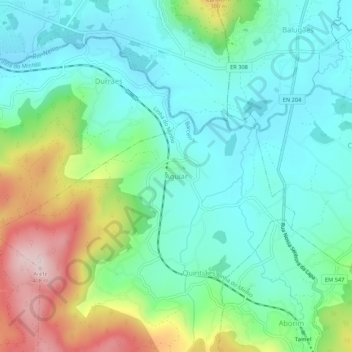
Name: Aguiar topographic map, elevation, terrain.
Location: Aguiar, Barcelos, Braga, 4905-231, Portugal (41.60652 -8.67408 41.64652 -8.63408)
Average elevation: 472 ft
Minimum elevation: 138 ft
Maximum elevation: 1,312 ft
Other topographic maps
Click on a map to view its topography, its elevation and its terrain.
Bastuço (Santo Estêvão)
Bastuço (Santo Estêvão), Barcelos, Braga, 4704-807, Portugal
Average elevation: 643 ft