
Oliveira topographic map
Interactive map
Click on the map to display elevation.
About this map
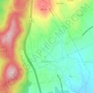
Name: Oliveira topographic map, elevation, terrain.
Location: Oliveira, Barcelos, Braga, Portugal (41.57297 -8.56400 41.59965 -8.53032)
Average elevation: 486 ft
Minimum elevation: 112 ft
Maximum elevation: 1,024 ft
Other topographic maps
Click on a map to view its topography, its elevation and its terrain.
Bastuço (Santo Estêvão)
Bastuço (Santo Estêvão), Barcelos, Braga, 4704-807, Portugal
Average elevation: 643 ft