
Chatham Township topographic map
Interactive map
Click on the map to display elevation.
About this map
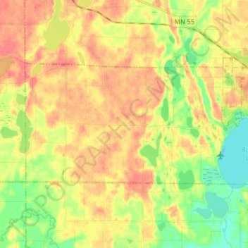
Name: Chatham Township topographic map, elevation, terrain.
Location: Chatham Township, Wright County, Minnesota, United States (45.15110 -94.01273 45.19578 -93.88359)
Average elevation: 991 ft
Minimum elevation: 896 ft
Maximum elevation: 1,066 ft
Other topographic maps
Click on a map to view its topography, its elevation and its terrain.
Franklin Township
United States > Minnesota > Wright County
Franklin Township, Wright County, Minnesota, United States
Average elevation: 951 ft