Geolocate

Strandburg topographic map

Click on the map to display elevation.

About this map

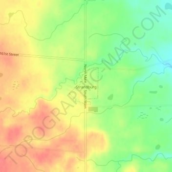
Name: Strandburg topographic map, elevation, terrain.

Location: Strandburg, Grant County, South Dakota, United States (45.04139 -96.76444 45.04712 -96.75796)

Average elevation: 1,680 ft

Minimum elevation: 1,572 ft

Maximum elevation: 1,772 ft

Grant County trails, hiking, mountain biking, running and outdoor activities

Gear up for your next adventure:

🔪Outdoor Multitools - Essential survival tools for gear repair and field use
📶Vehicle Signal Boosters - Improve reception in rural areas while driving to trailheads
GPS Sports Watch - GPS watch for running, hiking and training
🧺Microfiber Travel Towels - Compact and fast-drying towels for trail use
🧦Hiking Socks - Comfortable socks to prevent blisters on long hikes

As an Amazon Associate, this site earns from qualifying purchases at no extra cost to you.