
Thank you for supporting this site ❤️
Make a donation
Make a donation
Gear up for your next adventure:
As an Amazon Associate, this site earns from qualifying purchases at no extra cost to you.
Revoleto topographic map
Click on the map to display elevation.
Thank you for supporting this site ❤️
Make a donation
Make a donation
Gear up for your next adventure:
As an Amazon Associate, this site earns from qualifying purchases at no extra cost to you.
About this map
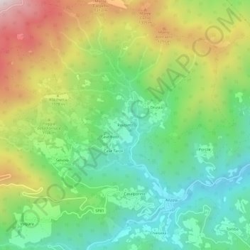
Name: Revoleto topographic map, elevation, terrain.
Location: Revoleto, Bedonia, Parma, Emilia-Romagna, Italia (44.51829 9.52794 44.55829 9.56794)
Average elevation: 3,409 ft
Minimum elevation: 2,421 ft
Maximum elevation: 5,049 ft
Thank you for supporting this site ❤️
Make a donation
Make a donation
Gear up for your next adventure:
As an Amazon Associate, this site earns from qualifying purchases at no extra cost to you.