Geolocate

Rockaway topographic map

Click on the map to display elevation.

About this map

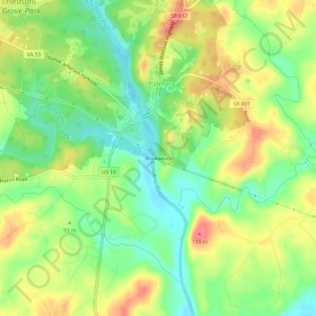
Name: Rockaway topographic map, elevation, terrain.

Location: Rockaway, Palmyra, Fluvanna County, Virginia, United States (37.83153 -78.28389 37.87153 -78.24389)

Average elevation: 318 ft

Minimum elevation: 210 ft

Maximum elevation: 443 ft

Fluvanna County trails, hiking, mountain biking, running and outdoor activities

Gear up for your next adventure:

🥇GPS Hiking Watch - Multi‑sport GPS watch with navigation and trail tracking
🧥Men's Rain Shells - Premium waterproof and breathable jackets for mountain weather
📡Handheld GPS Device - Reliable handheld GPS for outdoor navigation
🔪Outdoor Multitools - Essential survival tools for gear repair and field use
🧯Emergency Survival Kit - All‑in‑one survival essentials for the backcountry

As an Amazon Associate, this site earns from qualifying purchases at no extra cost to you.