Geolocate
👉 Easily get elevation data in JSON, GeoTIFF and KML formats using Elevation API
Thank you for supporting this site ❤️
Make a donation

Marshall topographic map

Click on the map to display elevation.

About this map

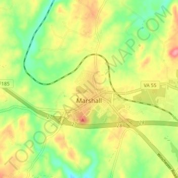
Name: Marshall topographic map, elevation, terrain.

Location: Marshall, Fauquier County, Virginia, United States (38.85778 -77.87704 38.87801 -77.81422)

Average elevation: 620 ft

Minimum elevation: 472 ft

Maximum elevation: 781 ft

Fauquier County trails, hiking, mountain biking, running and outdoor activities

Gear up for your next adventure:

🔦LED Headlamp - Bright and durable LED headlamp for night navigation
🔌USB Car Charger - Car charger for on‑the‑go power needs
🥘Titanium Cookware - Durable, featherlight pots and pans for backpacking
🧭Hiking Compass - Precision compass for reliable navigation in the wilderness
🧦Merino Wool Socks - Moisture-wicking, blister-preventing socks for long treks

As an Amazon Associate, this site earns from qualifying purchases at no extra cost to you.