Geolocate

Castellazzo topographic map

Click on the map to display elevation.

About this map

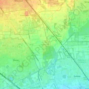
Name: Castellazzo topographic map, elevation, terrain.

Location: Castellazzo, Bollate, Milano, Lombardia, 20021, Italia (45.53696 9.07658 45.57696 9.11658)

Average elevation: 541 ft

Minimum elevation: 486 ft

Maximum elevation: 610 ft

Gear up for your next adventure:

GPS Sports Watch - GPS watch for running, hiking and training
📱Solar Portable Charger - Solar power bank for charging devices off‑grid
🌡️Handheld Weather Meters - Measure wind, temp, and pressure for safe mountain travel
🚗GPS Dash Cams - Record your scenic drives through mountain passes and canyons
👓Polarized Sunglasses - Outdoor sunglasses for glare reduction

As an Amazon Associate, this site earns from qualifying purchases at no extra cost to you.