Mutungo topographic map
Interactive map
Click on the map to display elevation.
About this map
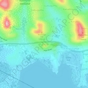
Name: Mutungo topographic map, elevation, terrain.
Location: Mutungo, Wakiso, Central Region, Uganda (0.18970 32.55777 0.22970 32.59777)
Average elevation: 3,839 ft
Minimum elevation: 3,711 ft
Maximum elevation: 4,291 ft
Other topographic maps
Click on a map to view its topography, its elevation and its terrain.
Nsekwa Musisi
Nsekwa Musisi, Wakiso, Central Region, Uganda
Average elevation: 3,878 ft
Kireku Railway
Kireku Railway, Wakiso, Central Region, Uganda
Average elevation: 3,809 ft
Lyamutundwe
Uganda > Wakiso > Lyamutundwe
Lyamutundwe, Wakiso, Central Region, P.O. BOX 182 - ENTEBBE, Uganda
Average elevation: 3,789 ft