Geolocate

Bolhoon topographic map

Click on the map to display elevation.

About this map

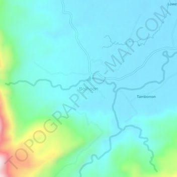
Name: Bolhoon topographic map, elevation, terrain.

Location: Bolhoon, San Miguel, Surigao del Sur, Caraga, Philippines (8.84239 125.95452 8.88239 125.99452)

Average elevation: 302 ft

Minimum elevation: 39 ft

Maximum elevation: 1,565 ft

Gear up for your next adventure:

🛌Ultralight Sleeping Bags - Compact down bags for cold nights in the wilderness
🛰️Satellite Messengers - Emergency SOS and two-way messaging for off-grid adventures
🪓Survival Multi‑Tool - Versatile tool for camp and trail tasks
📻Weather Alert Radios - Stay informed of storm risks while off-the-grid
🌎3D Topographic Globes - Raised relief globes for a tactile understanding of geography

As an Amazon Associate, this site earns from qualifying purchases at no extra cost to you.