
Thank you for supporting this site ❤️
Make a donation
Make a donation
Gear up for your next adventure:
As an Amazon Associate, this site earns from qualifying purchases at no extra cost to you.
Semanggi topographic map
Click on the map to display elevation.
Thank you for supporting this site ❤️
Make a donation
Make a donation
Gear up for your next adventure:
As an Amazon Associate, this site earns from qualifying purchases at no extra cost to you.
About this map
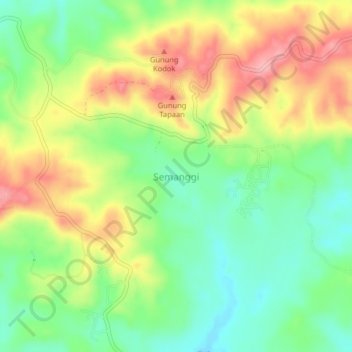
Name: Semanggi topographic map, elevation, terrain.
Location: Semanggi, Blora, Central Java, Java, Indonesia (-7.09054 111.40868 -7.05054 111.44868)
Average elevation: 571 ft
Minimum elevation: 367 ft
Maximum elevation: 840 ft
Thank you for supporting this site ❤️
Make a donation
Make a donation
Gear up for your next adventure:
As an Amazon Associate, this site earns from qualifying purchases at no extra cost to you.