Geolocate

Lake Catamount topographic map

Click on the map to display elevation.

About this map

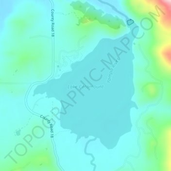
Name: Lake Catamount topographic map, elevation, terrain.

Location: Lake Catamount, Routt County, Colorado, United States (40.34494 -106.82072 40.36500 -106.79865)

Average elevation: 6,978 ft

Minimum elevation: 6,854 ft

Maximum elevation: 7,631 ft

Routt County trails, hiking, mountain biking, running and outdoor activities

Other topographic maps

Click on a map to view its topography, its elevation and its terrain.

Steamboat Lake

United States > Colorado > Routt County

Average elevation: 8,084 ft

Pagoda

United States > Colorado > Routt County

Average elevation: 6,850 ft

Gore Mountain

United States > Colorado > Routt County

Average elevation: 10,180 ft

Sugar Loaf Mountain

United States > Colorado > Routt County

Average elevation: 9,186 ft

Hahns Peak

United States > Colorado > Routt County

Average elevation: 9,482 ft

Oak Creek

United States > Colorado > Routt County

Average elevation: 7,628 ft

Gear up for your next adventure:

🏕️Tent Footprint - Protect your tent base from wear
📚USA Hiking Guide Books - Top trail guides and map books
🔪Outdoor Multitools - Essential survival tools for gear repair and field use
🎒Day Hiking Backpack - Lightweight backpack perfect for day trips and outdoor adventures
🔋Rechargeable Batteries - Power up your outdoor devices

As an Amazon Associate, this site earns from qualifying purchases at no extra cost to you.