
Thank you for supporting this site ❤️
Make a donation
Make a donation
Gear up for your next adventure:
As an Amazon Associate, this site earns from qualifying purchases at no extra cost to you.
Gyazhugling topographic map
Click on the map to display elevation.
Thank you for supporting this site ❤️
Make a donation
Make a donation
Gear up for your next adventure:
As an Amazon Associate, this site earns from qualifying purchases at no extra cost to you.
About this map
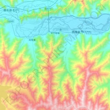
Name: Gyazhugling topographic map, elevation, terrain.
Location: Gyazhugling, Gonggar County, Lhoka, Tibet, China (29.06244 90.83369 29.38369 91.00655)
Average elevation: 13,655 ft
Minimum elevation: 11,680 ft
Maximum elevation: 17,848 ft
Thank you for supporting this site ❤️
Make a donation
Make a donation
Gear up for your next adventure:
As an Amazon Associate, this site earns from qualifying purchases at no extra cost to you.