Geolocate

Hubbard topographic map

Click on the map to display elevation.

About this map

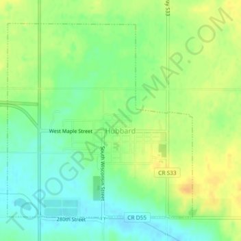
Name: Hubbard topographic map, elevation, terrain.

Location: Hubbard, Hardin County, Iowa, 50122, United States (42.29587 -93.31454 42.31766 -93.28645)

Average elevation: 1,096 ft

Minimum elevation: 1,050 ft

Maximum elevation: 1,145 ft

Hardin County trails, hiking, mountain biking, running and outdoor activities

Other topographic maps

Click on a map to view its topography, its elevation and its terrain.

Garden City

United States > Iowa > Hardin County

Average elevation: 1,178 ft

Gifford

United States > Iowa > Hardin County

Average elevation: 971 ft

Gear up for your next adventure:

🧭Outdoor Navigation Book - Learn advanced navigation skills
🔭Stargazing Telescopes - Perfect for camping in low-light pollution areas shown on maps
🎒Day Hiking Backpack - Lightweight backpack perfect for day trips and outdoor adventures
🎒Trekking Poles - Sturdy poles for balance and stability on rough terrain
🧦Merino Wool Socks - Moisture-wicking, blister-preventing socks for long treks

As an Amazon Associate, this site earns from qualifying purchases at no extra cost to you.