
Thank you for supporting this site ❤️
Make a donation
Make a donation
Gear up for your next adventure:
As an Amazon Associate, this site earns from qualifying purchases at no extra cost to you.
Cuautlamanca topographic map
Click on the map to display elevation.
Thank you for supporting this site ❤️
Make a donation
Make a donation
Gear up for your next adventure:
As an Amazon Associate, this site earns from qualifying purchases at no extra cost to you.
About this map
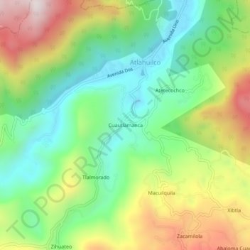
Name: Cuautlamanca topographic map, elevation, terrain.
Location: Cuautlamanca, Atlahuilco, Veracruz, México (18.66722 -97.11417 18.70722 -97.07417)
Average elevation: 6,663 ft
Minimum elevation: 5,689 ft
Maximum elevation: 8,205 ft
Thank you for supporting this site ❤️
Make a donation
Make a donation
Gear up for your next adventure:
As an Amazon Associate, this site earns from qualifying purchases at no extra cost to you.