Geolocate

Yayu topographic map

Click on the map to display elevation.

About this map

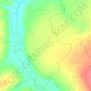
Name: Yayu topographic map, elevation, terrain.

Location: Yayu, Katagum, Bauchi State, Nigeria (11.48834 10.53591 11.62575 10.62161)

Average elevation: 1,322 ft

Minimum elevation: 1,250 ft

Maximum elevation: 1,427 ft

Gear up for your next adventure:

🪵Folding Camp Saw - Compact saw for wood and campsite work
🕶️Glacier Sunglasses - Side shields to protect eyes from high-altitude snow glare
🧢Sun Protection Hats - Wide-brimmed and UPF-rated hats for high-altitude sun safety
🧯Emergency Survival Kit - All‑in‑one survival essentials for the backcountry
📡GPS Antenna Upgrade - Enhance GPS reception in remote terrain

As an Amazon Associate, this site earns from qualifying purchases at no extra cost to you.