Geolocate

Granda topographic map

Click on the map to display elevation.

About this map

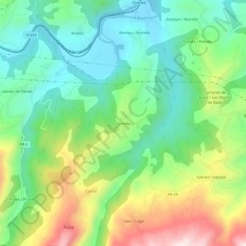
Name: Granda topographic map, elevation, terrain.

Location: Granda, Parres, Asturias, 33559, Spain (43.33007 -5.20742 43.37007 -5.16742)

Average elevation: 656 ft

Minimum elevation: 105 ft

Maximum elevation: 1,703 ft

Gear up for your next adventure:

🩳Quick‑Dry Hiking Shorts - Comfortable and quick‑dry shorts for summer hiking
🔌USB Car Charger - Car charger for on‑the‑go power needs
🔥Camping Stove - Portable stove for camping and backcountry cooking
🌡️Handheld Weather Meters - Measure wind, temp, and pressure for safe mountain travel
🎒Trekking Poles - Sturdy poles for balance and stability on rough terrain

As an Amazon Associate, this site earns from qualifying purchases at no extra cost to you.