
Thank you for supporting this site ❤️
Make a donation
Make a donation
Gear up for your next adventure:
As an Amazon Associate, this site earns from qualifying purchases at no extra cost to you.
Nyamata topographic map
Click on the map to display elevation.
Thank you for supporting this site ❤️
Make a donation
Make a donation
Gear up for your next adventure:
As an Amazon Associate, this site earns from qualifying purchases at no extra cost to you.
About this map
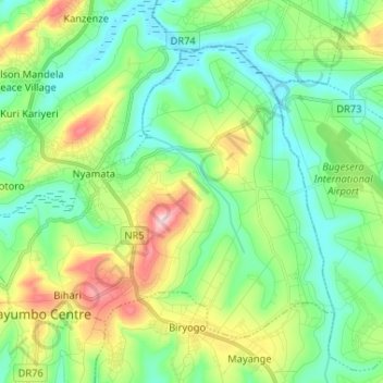
Name: Nyamata topographic map, elevation, terrain.
Location: Nyamata, Bugesera District, Eastern Province, Rwanda (-2.19907 30.04129 -2.09969 30.17113)
Average elevation: 4,659 ft
Minimum elevation: 4,386 ft
Maximum elevation: 5,299 ft
Thank you for supporting this site ❤️
Make a donation
Make a donation
Gear up for your next adventure:
As an Amazon Associate, this site earns from qualifying purchases at no extra cost to you.