Geolocate

Gragg topographic map

Click on the map to display elevation.

About this map

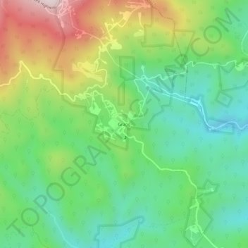
Name: Gragg topographic map, elevation, terrain.

Location: Gragg, Avery County, North Carolina, United States (36.05318 -81.79066 36.09318 -81.75066)

Average elevation: 2,707 ft

Minimum elevation: 1,959 ft

Maximum elevation: 4,075 ft

Avery County trails, hiking, mountain biking, running and outdoor activities

Other topographic maps

Click on a map to view its topography, its elevation and its terrain.

Grandfather

United States > North Carolina > Avery County

Average elevation: 4,275 ft

Crossnore

United States > North Carolina > Avery County

Average elevation: 3,481 ft

Gear up for your next adventure:

🌐World Map Poster - Decorative world maps with topographic info
🪶Wildlife Field Guides - Learn animal tracking and species ID
🧤Tactile Hiking Gloves - Keep hands warm while operating GPS and smartphone screens
🔌Solar Panel Charger - Charge gear sustainably outdoors
📶Vehicle Signal Boosters - Improve reception in rural areas while driving to trailheads

As an Amazon Associate, this site earns from qualifying purchases at no extra cost to you.