
Highland topographic map
Click on the map to display elevation.
About this map
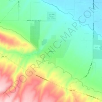
Name: Highland topographic map, elevation, terrain.
Location: Highland, Benton County, Washington, United States (46.12236 -119.09876 46.16236 -119.05876)
Average elevation: 643 ft
Minimum elevation: 341 ft
Maximum elevation: 1,138 ft
Benton County trails, hiking, mountain biking, running and outdoor activities
Other topographic maps
Click on a map to view its topography, its elevation and its terrain.