Geolocate

Troiani topographic map

Click on the map to display elevation.

About this map

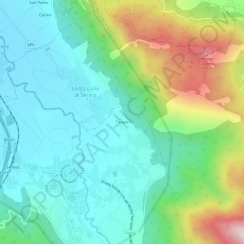
Name: Troiani topographic map, elevation, terrain.

Location: Troiani, Sala, Serino, Avellino, Campania, 83028, Italy (40.84539 14.86394 40.88539 14.90394)

Average elevation: 1,972 ft

Minimum elevation: 1,135 ft

Maximum elevation: 4,147 ft

Gear up for your next adventure:

🪶Camping Sleeping Pad - Comfortable sleeping pad for backpacking
🧭Orienteering Set - Complete compass and map reading kit
🗺️NatGeo Topo Maps - High-quality waterproof printed topographic maps of US Parks
🧤Tactile Hiking Gloves - Keep hands warm while operating GPS and smartphone screens
🛡️Insect Repellent - Protection against bugs during outdoor activities

As an Amazon Associate, this site earns from qualifying purchases at no extra cost to you.