
Meskiana topographic map
Interactive map
Click on the map to display elevation.
About this map
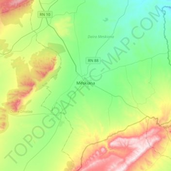
Name: Meskiana topographic map, elevation, terrain.
Location: Meskiana, Daïra Meskiana, Oum El Bouaghi, Algérie (35.49908 7.58841 35.75127 7.78127)
Average elevation: 3,120 ft
Minimum elevation: 2,392 ft
Maximum elevation: 4,659 ft
Other topographic maps
Click on a map to view its topography, its elevation and its terrain.
Aïn Chadjra
Algérie > Oum El Bouaghi > Daïra Meskiana > Aïn Chadjra
Aïn Chadjra, El Rahia, Daïra Meskiana, Oum El Bouaghi, Algérie
Average elevation: 3,369 ft