Geolocate

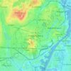
Furesø Municipality topographic map

Click on the map to display elevation.

About this map

Name: Furesø Municipality topographic map, elevation, terrain.

Location: Furesø Municipality, Capital Region of Denmark, Denmark (55.75239 12.29337 55.85150 12.43894)

Average elevation: 115 ft

Minimum elevation: 10 ft

Maximum elevation: 249 ft

Other topographic maps

Click on a map to view its topography, its elevation and its terrain.

Måløv

Denmark > Capital Region of Denmark > Måløv

Average elevation: 82 ft

Farum

Denmark > Capital Region of Denmark

Average elevation: 121 ft

Elsinore

Denmark > Capital Region of Denmark

Average elevation: 36 ft

Gear up for your next adventure:

🪵Folding Camp Saw - Compact saw for wood and campsite work
🪶Camping Sleeping Pad - Comfortable sleeping pad for backpacking
☕Camping Coffee Makers - Enjoy premium coffee at the summit or campsite
⌚GPS Sports Watch - GPS watch for running, hiking and training
🪶Survival Guide Book - Expert advice for emergency preparedness

As an Amazon Associate, this site earns from qualifying purchases at no extra cost to you.