Geolocate

Childers topographic map

Click on the map to display elevation.

About this map

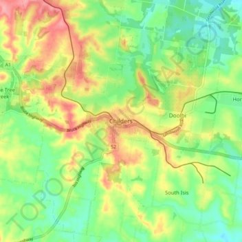
Name: Childers topographic map, elevation, terrain.

Location: Childers, Bundaberg Region, Queensland, 4660, Australia (-25.27454 152.23682 -25.19454 152.31682)

Average elevation: 259 ft

Minimum elevation: 115 ft

Maximum elevation: 453 ft

Gear up for your next adventure:

🌄Hiking Binoculars - Compact binoculars for scenic views and trail spotting
🛶Inflatable Kayak - Portable kayak for rivers, lakes, and expeditions
🛰️Satellite Messengers - Emergency SOS and two-way messaging for off-grid adventures
🧣Merino Neck Gaiters - Multi-functional headwear for wind and sun protection
🪶Trail Camera - Capture wildlife on your hikes

As an Amazon Associate, this site earns from qualifying purchases at no extra cost to you.