
Thank you for supporting this site ❤️
Make a donation
Make a donation
Gear up for your next adventure:
As an Amazon Associate, this site earns from qualifying purchases at no extra cost to you.
Schaumburg topographic map
Click on the map to display elevation.
Thank you for supporting this site ❤️
Make a donation
Make a donation
Gear up for your next adventure:
As an Amazon Associate, this site earns from qualifying purchases at no extra cost to you.
About this map
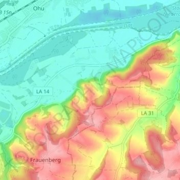
Name: Schaumburg topographic map, elevation, terrain.
Location: Schaumburg, Frauenberg, Landshut, Bavaria, 84036, Germany (48.56046 12.23751 48.60046 12.27751)
Average elevation: 1,375 ft
Minimum elevation: 1,204 ft
Maximum elevation: 1,627 ft
Thank you for supporting this site ❤️
Make a donation
Make a donation
Gear up for your next adventure:
As an Amazon Associate, this site earns from qualifying purchases at no extra cost to you.