Geolocate

Grezzano topographic map

Click on the map to display elevation.

About this map

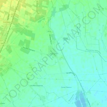
Name: Grezzano topographic map, elevation, terrain.

Location: Grezzano, Mozzecane, Verona, Veneto, 37060, Italia (45.29576 10.83829 45.33576 10.87829)

Average elevation: 138 ft

Minimum elevation: 112 ft

Maximum elevation: 174 ft

Gear up for your next adventure:

Backpacking Tent - Lightweight and durable tent for multi‑day hikes
🔋Solar Power Banks - Keep your GPS and phone charged in remote wilderness areas
🌧️Backpack Rain Cover - Keep gear dry in wet weather
🎒Waterproof Dry Bags - Keep your electronics and maps dry inside your pack
🏕️Tent Footprint - Protect your tent base from wear

As an Amazon Associate, this site earns from qualifying purchases at no extra cost to you.