
Thank you for supporting this site ❤️
Make a donation
Make a donation
Gear up for your next adventure:
As an Amazon Associate, this site earns from qualifying purchases at no extra cost to you.
Turchia topographic map
Click on the map to display elevation.
Thank you for supporting this site ❤️
Make a donation
Make a donation
Gear up for your next adventure:
As an Amazon Associate, this site earns from qualifying purchases at no extra cost to you.
About this map
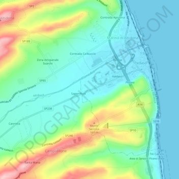
Name: Turchia topographic map, elevation, terrain.
Location: Turchia, Pedaso, Fermo, Marche, 63824, Italy (43.07315 13.80514 43.11315 13.84514)
Average elevation: 200 ft
Minimum elevation: -7 ft
Maximum elevation: 696 ft
Thank you for supporting this site ❤️
Make a donation
Make a donation
Gear up for your next adventure:
As an Amazon Associate, this site earns from qualifying purchases at no extra cost to you.