
Make a donation
Gear up for your next adventure:
As an Amazon Associate, this site earns from qualifying purchases at no extra cost to you.
Juno topographic map
Click on the map to display elevation.
Make a donation
Gear up for your next adventure:
As an Amazon Associate, this site earns from qualifying purchases at no extra cost to you.
About this map
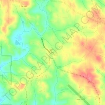
Name: Juno topographic map, elevation, terrain.
Location: Juno, Dawson County, Georgia, United States (34.45593 -84.21408 34.49593 -84.17408)
Average elevation: 1,490 ft
Minimum elevation: 1,355 ft
Maximum elevation: 1,627 ft
Make a donation
Gear up for your next adventure:
As an Amazon Associate, this site earns from qualifying purchases at no extra cost to you.
Other topographic maps
Click on a map to view its topography, its elevation and its terrain.
Amicalola Falls State Park
United States > Georgia > Dawson County > Dawsonville
Average elevation: 2,336 ft
Make a donation
Gear up for your next adventure:
As an Amazon Associate, this site earns from qualifying purchases at no extra cost to you.